

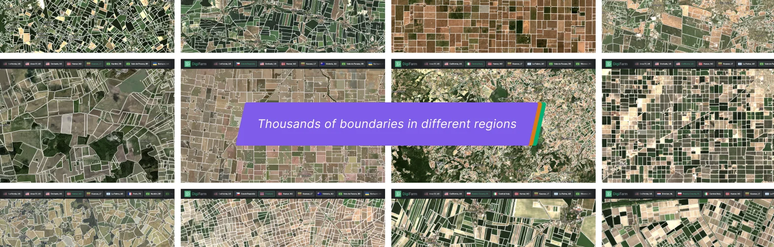
Global Coverage
We’re always working hard to bring new regions like France, Spain, Brazil, US, Australia, Germany and 30+ more.

Predictable Price
We've prepared a convenient system of discounts for increasing the volume of use. More requests - less price.

API-Ready
We provide full access to all our documentation and simple API / Add-ons endpoints for easy integration.

High Accuracy
12-15% higher than existing Cadastral map data (LPIS in EU and CLU’s in the US) and AI-solutions at 10m resolution.
How does field delineation model work?
We delineate field boundaries and seeded acres in the growing season based on the super-resolved Sentinel-2 at 1m per pixel using 4-bands (RGB + NIR) and we serve the latest, most up-to-date data through our API to your digital solution (or through Shape/KML/Geojson), which is crucial for in-season analysis and season-planning.


8+ Years of Data
We provide historical data (back to 2015) and in-season including seeded acres.

0.95 IoU Score
Intersection of Union average accuracy score of 0.94-0.96 for our FD Model.

200M+ hectares
Delineated agricultural fields and seeded acres using Sentinel-2 at 1m resolution.

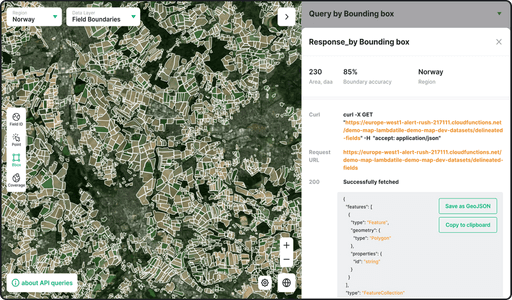
4 Query Types
We serve data via API so you can integrate it directly within your product.

We serve our field boundaries data via API with all documentation so you can integrate it directly within your solution.
Various API endpoints for your agricultural solution:

Data availability for a given bbox.
Automatically delineated low resolution field boundaries for a given bbox or as MVT vector tile (for selecting purpose).
Automatically delineated high resolution field boundaries for a given bbox, point or field id (taken from low res boundaries).
Deep Resolution Deep resolved Sentinel-2 images as raster tiles or within a given polygon (our proprietary technology that improves the resolution of Sentinel 2 imagery from 10 to 1 m).
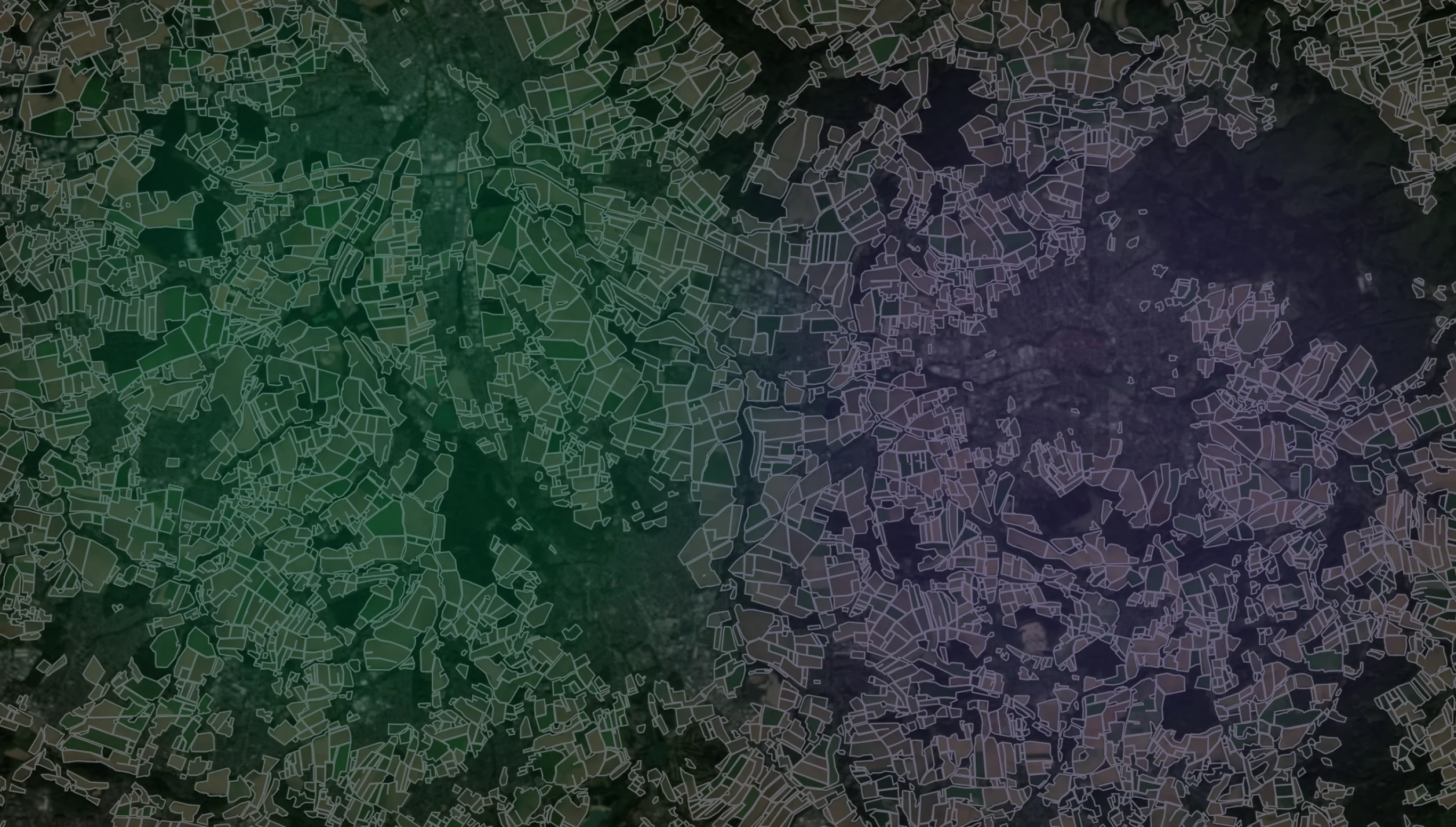
The beauty of field boundaries
Explore 25+ available regions with thousands of boundaries and request your area of interest if your region is not listed.

Why do accurate field boundaries matter?
Beyond farmers and growers, the entire agricultural value chain is affected by field boundary and seeded acreage data. Accurate boundary data can help the estimated 570 million farmers and growers worldwide boost their yields and lower their input costs.

Pre-production
Fungicides, herbicides and pesticide companies, plant breeding companies. All VRT starts with accurate field boundaries.

Processing & storage
Grain-traders, grain mills and logistical networks require field boundaries and current in-season seeded acres to forecast their grain volume inventories.

Wholesale & retail market
Grain buyers and food processors, carbon crediting bodies. Any carbon or sustainability mapping requires accurate field boundaries and seeded acres.

Autonomy & robotics
In-field autonomous agricultural machinery require highly accurate boundaries for reliable operations. RTK boundary is expensive and doesn't offer a scalability.

Distribution & logistics
FMS providers need to onboard and scale their user base. Manual digitization of field boundaries by farmers (end-users) is inaccurate and time consuming.

Crop insurance & subsidies
Crop insurance businesses and national paying agencies need to conduct manual field-controls of claims and subsidies -> costly and time-consuming.
Edit, split and merge boundaries
As a bonus and a very useful additional option - we provide the ability to change the field boundaries using our editor (basic functionality to edit, split, merge, add / remove holes).

Common Questions
What is the zoom-level/map resolution our service supports?
The base resolution is 1m for all data layers. We perform a comprehensive post processing of vector data (field boundaries and productivity zones) to make it smooth and native "looking".
Are there query limits on the testing API token?
Do you update your models?
Is the Sentinel-2 base map optional?
Technical Partners That Believe In Us


